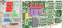
Or Footprint and its component footprints, to be more precise.
Visitors to the site have always been searching for maps of the VA and LSU Footprints, and until I created the linked Google map today, there's never been an adequate representation on the blog. I've replaced the old sidebar link, so clicking on the colorful icon at the top of the sidebar will now take you to the map hyperlinked above.
Notes for anyone who uses Streetview feature on the map...
1. The shots are from a moment in time that's closer to the immediate aftermath of Katrina.
2. The City of New Orleans imposed a moratorium on even repairing properties in the Footprint for a period post-storm in anticipation of the proposed hospitals.
3. The Streetview shots do not at all reflect the many changes in the VA Footprint due to demolitions and house moving that have transformed the area in the past four months.
Subscribe to:
Post Comments (Atom)
No comments:
Post a Comment